
Category:Mount Rainier National Park
United States national parks: Acadia · American Samoa · Arches · Badlands · Big Bend · Biscayne · Black Canyon of the Gunnison · Bryce Canyon · Canyonlands · Capitol Reef · Carlsbad Caverns · Channel Islands · Congaree · Crater Lake · Cuyahoga Valley · Death Valley · Denali · Dry Tortugas · Everglades · Gateway Arch · Gates of the Arctic · Glacier · Glacier Bay · Grand Canyon · Grand Teton · Great Basin · Great Sand Dunes · Great Smoky Mountains · Guadalupe Mountains · Haleakalā · Hawaii Volcanoes · Hot Springs · Indiana Dunes · Isle Royale · Joshua Tree · Katmai · Kenai Fjords · Kings Canyon · Kobuk Valley · Lake Clark · Lassen Volcanic · Mammoth Cave · Mesa Verde · Mount Rainier · New River Gorge · North Cascades · Olympic · Petrified Forest · Pinnacles · Redwood · Rocky Mountain · Saguaro · Sequoia · Shenandoah · Theodore Roosevelt · Virgin Islands · Voyageurs · White Sands · Wind Cave · Wrangell-St. Elias · Yellowstone · Yosemite · Zion
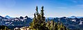
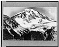
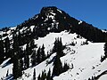
Images of Mount Rainier National Park. Images of Mount Rainier itself can be found in Category:Mount Rainier.
|
This is a category about a place or building that is listed on the National Register of Historic Places in the United States of America. Its reference number is 97000344 (Wikidata). |
national park of the United States    | |||||
| Upload media | |||||
| Instance of | |||||
|---|---|---|---|---|---|
| Named after | |||||
| Location |
| ||||
| Visitor center | |||||
| Operator | |||||
| IUCN protected areas category | |||||
| Inception |
| ||||
| Mountain range | |||||
| Highest point | |||||
| Population |
| ||||
| Area |
| ||||
| Visitors per year |
| ||||
| Different from | |||||
| official website | |||||
 | |||||
Subcategories
This category has the following 24 subcategories, out of 24 total.
*
A
H
M
N
P
R
S
T
V
Pages in category "Mount Rainier National Park"
This category contains only the following page.
Media in category "Mount Rainier National Park"
The following 189 files are in this category, out of 189 total.
-
.jpg/120px-A_-_panoramio_(22).jpg) A - panoramio (22).jpg 3,264 × 2,448; 3.79 MB
A - panoramio (22).jpg 3,264 × 2,448; 3.79 MB
-
 Avalanche Chute 5952.JPG 2,848 × 4,272; 5.34 MB
-
 Avalanche Chute 5956.JPG 2,848 × 4,272; 6.31 MB
-
 Puyallup River Valley and Mount Rainier by Albert Bierstadt.jpg 2,436 × 2,936; 1.15 MB
-
.jpg/120px-Dated_111981._slide_(ec52e35398294675a10d82fcc1173367).jpg) Dated 111981. slide (ec52e35398294675a10d82fcc1173367).jpg 1,457 × 2,140; 1,000 KB
Dated 111981. slide (ec52e35398294675a10d82fcc1173367).jpg 1,457 × 2,140; 1,000 KB
-
.JPG/120px-Falling_snow_on_rock_and_colored_bush._October_2008_(76ea9b28695f4609bfc0827058ee2640).JPG) Falling snow on rock and colored bush. October 2008 (76ea9b28695f4609bfc0827058ee2640).JPG 2,560 × 1,920; 2.23 MB
Falling snow on rock and colored bush. October 2008 (76ea9b28695f4609bfc0827058ee2640).JPG 2,560 × 1,920; 2.23 MB
-
.JPG/120px-Fir_tree_and_shadow_against_andesite_rock._(5cb47813920f4c84a2f5a98472ad0d65).JPG) Fir tree and shadow against andesite rock. (5cb47813920f4c84a2f5a98472ad0d65).JPG 2,560 × 1,920; 2.29 MB
Fir tree and shadow against andesite rock. (5cb47813920f4c84a2f5a98472ad0d65).JPG 2,560 × 1,920; 2.29 MB
-
 Flood trim lines - 48481836131.jpg 4,896 × 3,672; 9.09 MB
-
.JPG/120px-From_above_Glacier_Vista_(4a50a0be95294dc8a3218fdc5e11363f).JPG) From above Glacier Vista (4a50a0be95294dc8a3218fdc5e11363f).JPG 2,816 × 2,112; 2.13 MB
From above Glacier Vista (4a50a0be95294dc8a3218fdc5e11363f).JPG 2,816 × 2,112; 2.13 MB
-
.jpg/120px-Glacial_Valley_(3735730413).jpg) Glacial Valley (3735730413).jpg 2,592 × 3,888; 4.06 MB
Glacial Valley (3735730413).jpg 2,592 × 3,888; 4.06 MB
-
.JPG/120px-Hillside_at_4th_Crossing_with_snow._(4accf261615d4d77973706834c5e5509).JPG) Hillside at 4th Crossing with snow. (4accf261615d4d77973706834c5e5509).JPG 2,560 × 1,920; 2.37 MB
Hillside at 4th Crossing with snow. (4accf261615d4d77973706834c5e5509).JPG 2,560 × 1,920; 2.37 MB
-
.JPG/120px-Knob_west_of_Seymour_near_Dewey_Lake_(51efb275aa5b43058616e7cfee2c6878).JPG) Knob west of Seymour near Dewey Lake (51efb275aa5b43058616e7cfee2c6878).JPG 2,560 × 1,920; 2.32 MB
Knob west of Seymour near Dewey Lake (51efb275aa5b43058616e7cfee2c6878).JPG 2,560 × 1,920; 2.32 MB
-
.JPG/120px-Lava_strata_(eb7270b6a0fa4d38b8a01320ce6cad2e).JPG) Lava strata (eb7270b6a0fa4d38b8a01320ce6cad2e).JPG 2,560 × 1,920; 2.33 MB
Lava strata (eb7270b6a0fa4d38b8a01320ce6cad2e).JPG 2,560 × 1,920; 2.33 MB
-
.JPG/120px-Lone_tree_above_snow_field._(a626d559930340cbbcb28c2170725ca1).JPG) Lone tree above snow field. (a626d559930340cbbcb28c2170725ca1).JPG 2,816 × 2,112; 1.87 MB
Lone tree above snow field. (a626d559930340cbbcb28c2170725ca1).JPG 2,816 × 2,112; 1.87 MB
-
.jpg/120px-Looking_down_to_west_side_(1456232257).jpg) Looking down to west side (1456232257).jpg 1,024 × 768; 818 KB
Looking down to west side (1456232257).jpg 1,024 × 768; 818 KB
-
 Looking northeast from the southern slopes of Old Desolate.jpg 4,032 × 2,268; 2.53 MB
-
.JPG/120px-Mist_(c80b7b705c6a4005a79d7380dc5f1432).JPG) Mist (c80b7b705c6a4005a79d7380dc5f1432).JPG 2,560 × 1,920; 1.65 MB
Mist (c80b7b705c6a4005a79d7380dc5f1432).JPG 2,560 × 1,920; 1.65 MB
-
.JPG/120px-Mist%2C_fresh_snow_on_lower_mountain_(536b119356ca434fa742b1cacb5d8978).JPG) Mist, fresh snow on lower mountain (536b119356ca434fa742b1cacb5d8978).JPG 2,560 × 1,920; 1.69 MB
Mist, fresh snow on lower mountain (536b119356ca434fa742b1cacb5d8978).JPG 2,560 × 1,920; 1.69 MB
-
 Mount Adams 23093.JPG 2,560 × 1,920; 2.29 MB
-
-

-
Mount Rainier Holiday Hearth.webm 33 min 2 s, 1,920 × 1,080; 254.66 MB
-
 Mount Rainier model 04.jpg 4,288 × 2,848; 5.11 MB
-
.jpg/120px-Mount_Rainier_National_Park_(32039243623).jpg) Mount Rainier National Park (32039243623).jpg 2,955 × 1,947; 2.88 MB
Mount Rainier National Park (32039243623).jpg 2,955 × 1,947; 2.88 MB
-
.jpg/120px-Mount_Rainier_National_Park_(32453478210).jpg) Mount Rainier National Park (32453478210).jpg 3,264 × 2,448; 2.02 MB
Mount Rainier National Park (32453478210).jpg 3,264 × 2,448; 2.02 MB
-
.jpg/120px-Mount_Rainier_National_Park_(32680956432).jpg) Mount Rainier National Park (32680956432).jpg 3,264 × 2,308; 2.12 MB
Mount Rainier National Park (32680956432).jpg 3,264 × 2,308; 2.12 MB
-
.jpg/120px-Mount_Rainier_National_Park_(32680981982).jpg) Mount Rainier National Park (32680981982).jpg 3,264 × 2,448; 2.83 MB
Mount Rainier National Park (32680981982).jpg 3,264 × 2,448; 2.83 MB
-
.jpg/120px-Mount_Rainier_National_Park_(9287659863).jpg) Mount Rainier National Park (9287659863).jpg 2,880 × 2,160; 916 KB
Mount Rainier National Park (9287659863).jpg 2,880 × 2,160; 916 KB
-
.jpg/120px-Mount_Rainier_National_Park_(9287660415).jpg) Mount Rainier National Park (9287660415).jpg 2,880 × 2,160; 1.02 MB
Mount Rainier National Park (9287660415).jpg 2,880 × 2,160; 1.02 MB
-
.jpg/120px-Mount_Rainier_National_Park_(9287668327).jpg) Mount Rainier National Park (9287668327).jpg 2,880 × 2,160; 837 KB
Mount Rainier National Park (9287668327).jpg 2,880 × 2,160; 837 KB
-
.jpg/120px-Mount_Rainier_National_Park_(9290438954).jpg) Mount Rainier National Park (9290438954).jpg 2,880 × 2,160; 919 KB
Mount Rainier National Park (9290438954).jpg 2,880 × 2,160; 919 KB
-
.jpg/120px-Mount_Rainier_National_Park_(9290439476).jpg) Mount Rainier National Park (9290439476).jpg 2,160 × 2,880; 1.06 MB
Mount Rainier National Park (9290439476).jpg 2,160 × 2,880; 1.06 MB
-
.jpg/120px-Mount_Rainier_National_Park_(9290441578).jpg) Mount Rainier National Park (9290441578).jpg 2,880 × 2,160; 1.15 MB
Mount Rainier National Park (9290441578).jpg 2,880 × 2,160; 1.15 MB
-
.jpg/120px-Mount_Rainier_National_Park_(9290442696).jpg) Mount Rainier National Park (9290442696).jpg 2,880 × 2,160; 1.44 MB
Mount Rainier National Park (9290442696).jpg 2,880 × 2,160; 1.44 MB
-
.jpg/120px-Mount_Rainier_National_Park_(9290443802).jpg) Mount Rainier National Park (9290443802).jpg 2,880 × 2,160; 994 KB
Mount Rainier National Park (9290443802).jpg 2,880 × 2,160; 994 KB
-
.jpg/120px-Mount_Rainier_National_Park_(9290445474).jpg) Mount Rainier National Park (9290445474).jpg 2,880 × 2,160; 1.34 MB
Mount Rainier National Park (9290445474).jpg 2,880 × 2,160; 1.34 MB
-
.jpg/120px-Mount_Rainier_National_Park_(9290447890).jpg) Mount Rainier National Park (9290447890).jpg 2,880 × 2,160; 1.19 MB
Mount Rainier National Park (9290447890).jpg 2,880 × 2,160; 1.19 MB
-
 Mount Rainier National Park - 53023043942.jpg 3,072 × 4,080; 2.15 MB
-
 Mount Rainier National Park - 53023045902.jpg 4,080 × 3,072; 4.37 MB
-
 Mount Rainier National Park - 53023048597.jpg 4,080 × 3,072; 6.66 MB
-
 Mount Rainier National Park - 53023049377.jpg 3,072 × 4,080; 4.65 MB
-
 Mount Rainier National Park - 53023050677.jpg 4,080 × 3,072; 7.14 MB
-
 Mount Rainier National Park - 53023622151.jpg 4,080 × 3,072; 4.27 MB
-
 Mount Rainier National Park - 53023622236.jpg 3,072 × 4,080; 4.11 MB
-
 Mount Rainier National Park - 53023797649.jpg 4,080 × 3,072; 4.31 MB
-
 Mount Rainier National Park - 53024016265.jpg 4,080 × 3,072; 3.11 MB
-
 Mount Rainier National Park 01.jpg 2,400 × 1,600; 2.55 MB
-
 Mount Rainier National Park 2023-01.jpg 6,000 × 4,000; 3.22 MB
-
 Mount Rainier National Park 2023-03.jpg 6,000 × 4,000; 5.03 MB
-
 Mount Rainier National Park by JBK.JPG 4,000 × 3,000; 2.97 MB
-
 Mount Rainier National Park in Washington 2.jpg 2,048 × 1,536; 1.88 MB
-
 Mount Rainier National Park MORA1997.jpg 2,048 × 3,072; 4.28 MB
-
 Mount Rainier National Park MORA3218.jpg 2,048 × 3,072; 4.24 MB
-
.jpg/120px-Mount_Rainier_National_Park7468_(50496288766).jpg) Mount Rainier National Park7468 (50496288766).jpg 3,264 × 2,448; 2.94 MB
Mount Rainier National Park7468 (50496288766).jpg 3,264 × 2,448; 2.94 MB
-
.jpeg/120px-Mount_Rainier_Soundscape_Site_-_Crystal_2006_(ec1dce1e-1dd8-b71b-0be8-bb29c66291fb).jpeg)
-
 Mount rainier trail panorama3.jpg 2,592 × 1,944; 2.29 MB
-
 Mount Rainier with waterfall.jpg 3,024 × 4,032; 3 MB
-
.jpg/120px-Mount_St._Helen_from_the_Nisqually_Glcaier_(14492900099).jpg) Mount St. Helen from the Nisqually Glcaier (14492900099).jpg 5,184 × 3,456; 1.63 MB
Mount St. Helen from the Nisqually Glcaier (14492900099).jpg 5,184 × 3,456; 1.63 MB
-
.JPG/120px-Mountain_ash_with_berries_looking_beyond_subapline_fir_to_Unicorn_peak._(25e64366ed0343ea874c0b8bf907a3d0).JPG)
-
Mountain Moment- Berkeley Park Flowers.webm 36 s, 1,920 × 1,080; 40.11 MB
-
.jpg/120px-MRI_2013_Mount_Rainier_1_(10695429704).jpg) MRI 2013 Mount Rainier 1 (10695429704).jpg 5,760 × 3,840; 12.31 MB
MRI 2013 Mount Rainier 1 (10695429704).jpg 5,760 × 3,840; 12.31 MB
-
 Mt Rainer National Park - 53204834227.jpg 5,328 × 4,000; 25.46 MB
-
 Mt Rainer National Park - 53204834237.jpg 5,328 × 4,000; 27.56 MB
-
 Mt Rainer National Park - 53206094559.jpg 6,000 × 4,000; 23.17 MB
-
.JPG/120px-Mt_Rainier_(7b47d15ee8964712bd5e3d7cbe517fd9).JPG) Mt Rainier (7b47d15ee8964712bd5e3d7cbe517fd9).JPG 2,560 × 1,920; 2.36 MB
Mt Rainier (7b47d15ee8964712bd5e3d7cbe517fd9).JPG 2,560 × 1,920; 2.36 MB
-
 Mt Rainier Sunset Viewed From Frozen Lake.jpg 7,840 × 5,227; 36.52 MB
-
 Mt Rainier Wikivoyage banner.jpg 4,800 × 687; 3.32 MB
-
.jpg/120px-Mt._Rainier_(Unsplash).jpg) Mt. Rainier (Unsplash).jpg 3,648 × 2,432; 682 KB
Mt. Rainier (Unsplash).jpg 3,648 × 2,432; 682 KB
-
 Mt. Rainier and Mowich Canyon LCCN90709646.jpg 4,096 × 3,289; 2.51 MB
-
 Mt. Rainier and Mowich Canyon LCCN90709646.tif 4,096 × 3,289; 12.85 MB
-
 Mt. Rainier National Park.jpg 3,072 × 2,048; 2.63 MB
-
 Mt. Ranier from Unicorn Peak.jpg 4,032 × 3,024; 3.14 MB
-
 MTRainier2.JPG 3,888 × 2,592; 4.61 MB
-
 My campsite at Dick Creek.jpg 4,032 × 2,268; 1.88 MB
-
 Naches Peak from Chinook Pass.jpg 2,272 × 1,704; 837 KB
-
 Newly filled channel - 48481989682.jpg 4,896 × 3,672; 8.88 MB
-
.JPG/120px-Nisqually_Valley_(b0f5e264f7404c30a850c98b41de02c7).JPG) Nisqually Valley (b0f5e264f7404c30a850c98b41de02c7).JPG 2,560 × 1,920; 1.43 MB
Nisqually Valley (b0f5e264f7404c30a850c98b41de02c7).JPG 2,560 × 1,920; 1.43 MB
-
.JPG/120px-Oct_2008_(637b33261b2940dc86672bee6fc3f989).JPG) Oct 2008 (637b33261b2940dc86672bee6fc3f989).JPG 2,560 × 1,920; 2.18 MB
Oct 2008 (637b33261b2940dc86672bee6fc3f989).JPG 2,560 × 1,920; 2.18 MB
-
 Old Desolate from north.jpg 3,398 × 2,630; 2.17 MB
-
.JPG/120px-On_grass_and_rocks_(90c20c8f78684d7fbc97e5e1f594eb0b).JPG) On grass and rocks (90c20c8f78684d7fbc97e5e1f594eb0b).JPG 2,560 × 1,920; 2.36 MB
On grass and rocks (90c20c8f78684d7fbc97e5e1f594eb0b).JPG 2,560 × 1,920; 2.36 MB
-
_are_tiny_but_colorful_(a2db186c-6e8a-4249-b9d8-19876b191034).JPG/120px-thumbnail.jpg)
-
.jpg/120px-Outlet_of_Tahoma_Creek_from_glacier_(19957661863).jpg) Outlet of Tahoma Creek from glacier (19957661863).jpg 3,968 × 2,976; 2.72 MB
Outlet of Tahoma Creek from glacier (19957661863).jpg 3,968 × 2,976; 2.72 MB
-
 PAISAJE EN EL PARQUE NACIONAL - panoramio.jpg 4,288 × 2,848; 4.87 MB
-

-
.JPG/120px-Paradise_(04606d91544e4649aa6d86bb54fd124e).JPG) Paradise (04606d91544e4649aa6d86bb54fd124e).JPG 2,816 × 2,112; 2.33 MB
Paradise (04606d91544e4649aa6d86bb54fd124e).JPG 2,816 × 2,112; 2.33 MB
-
.JPG/120px-Paradise_(efd7e30a6a0041de9320bc66cc164a04).JPG) Paradise (efd7e30a6a0041de9320bc66cc164a04).JPG 2,560 × 1,920; 2.27 MB
Paradise (efd7e30a6a0041de9320bc66cc164a04).JPG 2,560 × 1,920; 2.27 MB
-
.jpg/120px-Park_road_crews_fit_enormous_boulders_together_like_a_3-dimentional_jigsaw_puzzle_to_build_a_stable_embankment._(c94e8db6-155d-4519-3e2d-c4d301d5f583).jpg)
-
 Pins.Tourism and Interests.jpg 1,246 × 910; 176 KB
-
 Pipkrake 2.jpg 2,457 × 2,099; 1.96 MB
-
 Pipkrake 3.jpg 2,958 × 2,448; 4.57 MB
-
 Pipkrake.jpg 2,720 × 2,448; 3.63 MB
-
.jpg/120px-Prarie_on_rainier_(3835315512).jpg) Prarie on rainier (3835315512).jpg 2,186 × 1,453; 945 KB
Prarie on rainier (3835315512).jpg 2,186 × 1,453; 945 KB
-
.JPG/120px-Probably_on_Mt._Wow_(a91a3d14a0b4453d84637c6d5ab3e9e1).JPG) Probably on Mt. Wow (a91a3d14a0b4453d84637c6d5ab3e9e1).JPG 2,560 × 1,920; 2.43 MB
Probably on Mt. Wow (a91a3d14a0b4453d84637c6d5ab3e9e1).JPG 2,560 × 1,920; 2.43 MB
-
.JPG/120px-Puget_Group_formation_(d4ce5b79e02448ef8a41c0786ae82c4d).JPG) Puget Group formation (d4ce5b79e02448ef8a41c0786ae82c4d).JPG 2,816 × 2,112; 2.71 MB
Puget Group formation (d4ce5b79e02448ef8a41c0786ae82c4d).JPG 2,816 × 2,112; 2.71 MB
-
.JPG/120px-Rainbow_(0938fbf46b7b4a368b768b160396d4f1).JPG) Rainbow (0938fbf46b7b4a368b768b160396d4f1).JPG 2,560 × 1,920; 1.94 MB
Rainbow (0938fbf46b7b4a368b768b160396d4f1).JPG 2,560 × 1,920; 1.94 MB
-
.JPG/120px-Rainbow_(0d20c28cb3c4483ba20d3aae2e782176).JPG) Rainbow (0d20c28cb3c4483ba20d3aae2e782176).JPG 2,560 × 1,920; 1.25 MB
Rainbow (0d20c28cb3c4483ba20d3aae2e782176).JPG 2,560 × 1,920; 1.25 MB
-
 Rainier - Flickr - lorenkerns.jpg 3,264 × 2,448; 2.21 MB
-
.jpg/120px-Rainier_Rocks_(5524103955).jpg) Rainier Rocks (5524103955).jpg 3,888 × 2,592; 7.01 MB
Rainier Rocks (5524103955).jpg 3,888 × 2,592; 7.01 MB
-
.jpg/120px-Rainier_Rocks_(5524704786).jpg) Rainier Rocks (5524704786).jpg 2,592 × 3,888; 6.16 MB
Rainier Rocks (5524704786).jpg 2,592 × 3,888; 6.16 MB
-
Recreate Responsibly at Mount Rainier.webm 4 min 2 s, 1,920 × 1,080; 160.42 MB
-
.JPG/120px-Rockslide_(9ebe4465e03c416e97c63f67eb7fa199).JPG) Rockslide (9ebe4465e03c416e97c63f67eb7fa199).JPG 2,816 × 2,112; 2.52 MB
Rockslide (9ebe4465e03c416e97c63f67eb7fa199).JPG 2,816 × 2,112; 2.52 MB
-
.JPG/120px-Scree_(00224e49d4004ceabe9df9f158c23916).JPG) Scree (00224e49d4004ceabe9df9f158c23916).JPG 2,560 × 1,920; 2.28 MB
Scree (00224e49d4004ceabe9df9f158c23916).JPG 2,560 × 1,920; 2.28 MB
-
.jpg/120px-Search_party_for_Forrest_Greathouse%2C_Mount_Rainier_National_Park%2C_July_1929_(MOHAI_4400).jpg)
-
 Side bank failure - 48481991862.jpg 4,896 × 3,672; 9.76 MB
-
.jpg/120px-Similar_to_8951._101981._slide_(5029f36abfbd43a29b96bf6c297ad790).jpg) Similar to 8951. 101981. slide (5029f36abfbd43a29b96bf6c297ad790).jpg 1,456 × 2,140; 702 KB
Similar to 8951. 101981. slide (5029f36abfbd43a29b96bf6c297ad790).jpg 1,456 × 2,140; 702 KB
-
.jpg/120px-Slide_(38ef18758fca4fbca725a276f86e4fa1).jpg) Slide (38ef18758fca4fbca725a276f86e4fa1).jpg 2,140 × 1,458; 947 KB
Slide (38ef18758fca4fbca725a276f86e4fa1).jpg 2,140 × 1,458; 947 KB
-
.JPG/120px-Small_mudflow_(93b97e68c7894674a275b4231f725834).JPG) Small mudflow (93b97e68c7894674a275b4231f725834).JPG 2,560 × 1,920; 2.02 MB
Small mudflow (93b97e68c7894674a275b4231f725834).JPG 2,560 × 1,920; 2.02 MB
-
 Small Peak and Sunset Clouds.jpg 12,883 × 4,690; 63.07 MB
-
 Snow Lake - 44275177325.jpg 6,000 × 4,000; 4.5 MB
-
.JPG/120px-Snow_on_moss-covered_branch._(955df020791442378a46574c9271730e).JPG) Snow on moss-covered branch. (955df020791442378a46574c9271730e).JPG 2,560 × 1,920; 2.36 MB
Snow on moss-covered branch. (955df020791442378a46574c9271730e).JPG 2,560 × 1,920; 2.36 MB
-
.jpg/120px-Snow_survey_snow_pillow._slide_(7871defcb2b443a987bfee45ef5edc54).jpg) Snow survey snow pillow. slide (7871defcb2b443a987bfee45ef5edc54).jpg 2,168 × 1,479; 580 KB
Snow survey snow pillow. slide (7871defcb2b443a987bfee45ef5edc54).jpg 2,168 × 1,479; 580 KB
-
 Snowfields 1214.JPG 4,272 × 2,848; 5.39 MB
-
 Snowfields 1235.JPG 4,272 × 2,848; 4.83 MB
-
 Source of outburst flood - 48481841366.jpg 4,896 × 3,672; 9.55 MB
-
 Source of outburst flood - 48481995597.jpg 4,896 × 3,672; 9.68 MB
-
.JPG/120px-Spray_Park_and_Hessong_Rock_(7b461952-c214-4e3b-abc7-a73b8ca0e1b7).JPG) Spray Park and Hessong Rock (7b461952-c214-4e3b-abc7-a73b8ca0e1b7).JPG 5,472 × 3,648; 8.41 MB
Spray Park and Hessong Rock (7b461952-c214-4e3b-abc7-a73b8ca0e1b7).JPG 5,472 × 3,648; 8.41 MB
-
.JPG/120px-Springs_(0794b491b34149ec9779db4eb09ee1da).JPG) Springs (0794b491b34149ec9779db4eb09ee1da).JPG 2,560 × 1,920; 1.46 MB
Springs (0794b491b34149ec9779db4eb09ee1da).JPG 2,560 × 1,920; 1.46 MB
-
.jpg/120px-Standing_on_the_Road_(c938de89-155d-4519-3ee5-14955946e945).jpg) Standing on the Road (c938de89-155d-4519-3ee5-14955946e945).jpg 1,280 × 960; 615 KB
Standing on the Road (c938de89-155d-4519-3ee5-14955946e945).jpg 1,280 × 960; 615 KB
-
.JPG/120px-Standing_snag_at_Sunrise._(20cde37d58044eb6b8d790a803a772f5).JPG) Standing snag at Sunrise. (20cde37d58044eb6b8d790a803a772f5).JPG 2,560 × 1,920; 2.22 MB
Standing snag at Sunrise. (20cde37d58044eb6b8d790a803a772f5).JPG 2,560 × 1,920; 2.22 MB
-
.JPG/120px-Striped_cliff_(3964703df6fc41f6bb5e6a296146da41).JPG) Striped cliff (3964703df6fc41f6bb5e6a296146da41).JPG 2,560 × 1,920; 1.96 MB
Striped cliff (3964703df6fc41f6bb5e6a296146da41).JPG 2,560 × 1,920; 1.96 MB
-
.JPG/120px-Subalpine_(bc49314ba7bc45a4ac1f828d78dbd265).JPG) Subalpine (bc49314ba7bc45a4ac1f828d78dbd265).JPG 2,816 × 2,112; 2.53 MB
Subalpine (bc49314ba7bc45a4ac1f828d78dbd265).JPG 2,816 × 2,112; 2.53 MB
-
 Subalpine fir 02.JPG 6,000 × 4,000; 11.04 MB
-
.JPG/120px-Subalpine_fir_in_meadow_(dbc71bf58f414db7a16204e0251098bf).JPG) Subalpine fir in meadow (dbc71bf58f414db7a16204e0251098bf).JPG 2,560 × 1,920; 2.07 MB
Subalpine fir in meadow (dbc71bf58f414db7a16204e0251098bf).JPG 2,560 × 1,920; 2.07 MB
-
 Subalpine zone 8222.JPG 2,848 × 4,272; 4.69 MB
-
 Subalpine zone 8223.JPG 2,848 × 4,272; 4.15 MB
-
 Subalpine zone 8227.JPG 2,848 × 4,272; 5.66 MB
-
 Subalpine zone 8228.JPG 2,848 × 4,272; 4.87 MB
-
 Subalpine zone 8233.JPG 2,848 × 4,272; 7.87 MB
-
 Subalpine zone 8234.JPG 2,848 × 4,272; 7.95 MB
-
 Subalpine zone 8235-37 panorama.jpg 5,427 × 4,101; 8.34 MB
-
 Subalpine zone 8235.JPG 2,848 × 4,272; 7.11 MB
-
 Subalpine zone 8236.JPG 2,848 × 4,272; 7.3 MB
-
 Subalpine zone 8237.JPG 2,848 × 4,272; 6.67 MB
-
 Subalpine zone 8238.JPG 2,848 × 4,272; 8.09 MB
-
 Subalpine zone 8239.JPG 2,848 × 4,272; 8.16 MB
-
 Subalpine zone 8240.JPG 2,848 × 4,272; 8.48 MB
-
 Subalpine zone 8242.JPG 2,848 × 4,272; 7.56 MB
-
 Subalpine zone 8243.JPG 2,848 × 4,272; 6.82 MB
-
 Subalpine zone 8244.JPG 2,848 × 4,272; 6.91 MB
-
 Subalpine zone 8350.JPG 4,272 × 2,848; 6.48 MB
-
 Subalpine zone 8359.JPG 4,272 × 2,848; 7.41 MB
-
 Subalpine zone 8365 panorama.jpg 6,557 × 2,784; 6.91 MB
-
 Subalpine zone 8365.JPG 4,272 × 2,848; 7.26 MB
-
 Subalpine zone 8430.JPG 4,272 × 2,848; 7.9 MB
-
 Subalpine zone 8436.JPG 2,848 × 4,272; 3.3 MB
-
 Subalpine zone 8443.JPG 2,848 × 4,272; 3.61 MB
-
 Subalpine zone 8444.JPG 2,848 × 4,272; 3.55 MB
-
 Subsidiary outlet channel - 48481994222.jpg 4,896 × 3,672; 9.97 MB
-
.jpg/120px-Summerland_at_Mt._Rainier_NP_in_WA_(50292002807).jpg) Summerland at Mt. Rainier NP in WA (50292002807).jpg 4,800 × 1,280; 5.48 MB
Summerland at Mt. Rainier NP in WA (50292002807).jpg 4,800 × 1,280; 5.48 MB
-
 Summerland at Mt. Rainier NP in WA - Flickr - landscapesinthewest.jpg 4,800 × 1,280; 5.26 MB
-
.JPG/120px-Sunbeans_through_forest%2C_possibly_near_Nisqually_Gate._(a9fc1827962140b4b93d8dd1da1a0c92).JPG)
-
.jpg/120px-Sunrise_(29194578774).jpg) Sunrise (29194578774).jpg 5,472 × 3,648; 3.94 MB
Sunrise (29194578774).jpg 5,472 × 3,648; 3.94 MB
-
.jpg/120px-Sunrise_(29785456236).jpg) Sunrise (29785456236).jpg 6,000 × 4,000; 10.02 MB
Sunrise (29785456236).jpg 6,000 × 4,000; 10.02 MB
-
 Sunrise - 45063476921.jpg 6,000 × 4,000; 7.73 MB
-
 Sunrise and trees in Moraine Park.jpg 4,032 × 2,268; 2.94 MB
-
.jpg/120px-Sunrise_on_the_Emmons_Glacier_(7421335940).jpg) Sunrise on the Emmons Glacier (7421335940).jpg 960 × 720; 50 KB
Sunrise on the Emmons Glacier (7421335940).jpg 960 × 720; 50 KB
-
.JPG/120px-Sunrise_Road_(ab0d0e54ba94459083b12d58ee0e43a7).JPG) Sunrise Road (ab0d0e54ba94459083b12d58ee0e43a7).JPG 2,816 × 2,112; 2.74 MB
Sunrise Road (ab0d0e54ba94459083b12d58ee0e43a7).JPG 2,816 × 2,112; 2.74 MB
-
 Sunset on Mt Rainier.jpg 8,256 × 5,504; 32.96 MB
-
.jpg/120px-Tahoma_Creek_Mass_Movement_Debris_Flow%2C_Mount_Rainier_NP_-_2015_(3c68bb63-4b9e-4880-8e7d-45524f990f56).jpg)
-
.jpg/120px-Tatoosh_Moon_Rise_(2844919506).jpg) Tatoosh Moon Rise (2844919506).jpg 683 × 1,024; 407 KB
Tatoosh Moon Rise (2844919506).jpg 683 × 1,024; 407 KB
-
.JPG/120px-Tatoosh_Range_(beb28633dc8f43f3b50bfd6fd1109f3b).JPG) Tatoosh Range (beb28633dc8f43f3b50bfd6fd1109f3b).JPG 2,560 × 1,920; 1.76 MB
Tatoosh Range (beb28633dc8f43f3b50bfd6fd1109f3b).JPG 2,560 × 1,920; 1.76 MB
-
.jpeg/120px-Tatoosh_Range_from_the_foot_of_Paradise_Glacier%2C_Mt_Rainier%2C_July_1911_(WASTATE_2295).jpeg)
-
 Tatoosh Range WA MRNP1.jpg 3,888 × 2,528; 5.78 MB
-
.jpg/120px-The_Longmire_Meadow_is_an_oasis_among_the_dense_forests_of_the_lower_elevation_slopes_of_Mount_Rainier._(8f7f4fca-1dd8-b71b-0b2f-5165abd8feee).jpg)
-
.jpg/120px-thumbnail.jpg)
-
.jpg/120px-thumbnail.jpg)
-
.jpg/120px-The_Town_Crier%2C_v.13%2C_no.32%2C_Aug._10%2C_1918_-_DPLA_-_37e0fda923e0c5ab45504ac9fc48bf06_(page_1).jpg)
-
.jpg/120px-The_Town_Crier%2C_v.15%2C_no.11%2C_Mar._13%2C_1920_-_DPLA_-_f612516f8dd53e0299a0c64f223cd978_(page_10).jpg)
-
 The Valley at Mount Rainier.jpg 4,608 × 3,072; 3.7 MB
-
.jpeg/120px-Tolmie_Peak_(163604119).jpeg) Tolmie Peak (163604119).jpeg 1,080 × 723; 263 KB
Tolmie Peak (163604119).jpeg 1,080 × 723; 263 KB
-
.jpg/120px-Tourist_cabins_and_facilities_at_Sunrise%2C_Yakima_Park%2C_Mount_Rainier_National_Park%2C_Washington%2C_ca_1930_(WASTATE_3).jpg)
-
.JPG/120px-Trees_(0bf99c05b9774ae491fba8ae690252b5).JPG) Trees (0bf99c05b9774ae491fba8ae690252b5).JPG 3,072 × 2,304; 2.08 MB
Trees (0bf99c05b9774ae491fba8ae690252b5).JPG 3,072 × 2,304; 2.08 MB
-
.JPG/120px-Trees_(0d75234ea2a0449fb10c80d186cb84c5).JPG) Trees (0d75234ea2a0449fb10c80d186cb84c5).JPG 2,560 × 1,920; 1.54 MB
Trees (0d75234ea2a0449fb10c80d186cb84c5).JPG 2,560 × 1,920; 1.54 MB
-
.JPG/120px-Trees_(105d8b33dca74ed8a1cf4bba52677193).JPG) Trees (105d8b33dca74ed8a1cf4bba52677193).JPG 2,560 × 1,920; 1.7 MB
Trees (105d8b33dca74ed8a1cf4bba52677193).JPG 2,560 × 1,920; 1.7 MB
-
.JPG/120px-Trees_(2db3bac686ba493aa8713b1dca01db0b).JPG) Trees (2db3bac686ba493aa8713b1dca01db0b).JPG 2,560 × 1,920; 2.38 MB
Trees (2db3bac686ba493aa8713b1dca01db0b).JPG 2,560 × 1,920; 2.38 MB
-
.JPG/120px-Trees_(5f19f4419a8347fda8284a907dbde824).JPG) Trees (5f19f4419a8347fda8284a907dbde824).JPG 3,072 × 2,304; 1.78 MB
Trees (5f19f4419a8347fda8284a907dbde824).JPG 3,072 × 2,304; 1.78 MB
-
.JPG/120px-Twisted_trees_at_sunset._(27b7f974bfde4c46954526c459305476).JPG) Twisted trees at sunset. (27b7f974bfde4c46954526c459305476).JPG 2,560 × 1,920; 2.33 MB
Twisted trees at sunset. (27b7f974bfde4c46954526c459305476).JPG 2,560 × 1,920; 2.33 MB
-
 USPS National Park Service 1934.jpg 903 × 742; 145 KB
-
 Valley beneath Glaciers - panoramio.jpg 4,608 × 2,592; 2.7 MB
-
.JPG/120px-View_of_Anvil_Rock_probably_from_Glacier_Vista._(841ced4e76a7478d9385bbef5acdf34e).JPG) View of Anvil Rock probably from Glacier Vista. (841ced4e76a7478d9385bbef5acdf34e).JPG 2,560 × 1,920; 2.04 MB
View of Anvil Rock probably from Glacier Vista. (841ced4e76a7478d9385bbef5acdf34e).JPG 2,560 × 1,920; 2.04 MB
-
.jpg/120px-View_of_Mt._Ranier_from_Ricksecker_Point_(14808746fd1c49ad93e49c9e20c84623).jpg)
-
 View of Mt.Rainier inside the park.jpg 3,524 × 1,982; 2.09 MB
-
.JPG/120px-Watchtowers_of_lava_over_Stevens_Canyon_(9a28c53c7dbc4343bdf879c866325348).JPG) Watchtowers of lava over Stevens Canyon (9a28c53c7dbc4343bdf879c866325348).JPG 2,560 × 1,920; 2.17 MB
Watchtowers of lava over Stevens Canyon (9a28c53c7dbc4343bdf879c866325348).JPG 2,560 × 1,920; 2.17 MB
-
.JPG/120px-Waterfall_trail_in_early_September_2015._(880eaa5311bb43df908dd4a978252561).JPG) Waterfall trail in early September 2015. (880eaa5311bb43df908dd4a978252561).JPG 2,816 × 2,112; 2.69 MB
Waterfall trail in early September 2015. (880eaa5311bb43df908dd4a978252561).JPG 2,816 × 2,112; 2.69 MB
-
 Westside Road flood revetments - 48481986382.jpg 4,896 × 3,672; 5.27 MB
-
 White River to Spray Park backpacking trip 24.jpg 4,032 × 2,268; 3.97 MB
-
 Whitman Crest 5851.JPG 2,848 × 4,272; 3.81 MB
-
 Yakima Park and Cowlitz Chimneys.jpg 2,098 × 1,214; 829 KB
-
.jpg/120px-Zoom_lens_(4936719343).jpg) Zoom lens (4936719343).jpg 1,024 × 768; 189 KB
Zoom lens (4936719343).jpg 1,024 × 768; 189 KB
.jpg)


.jpg)
.JPG)
.JPG)

.JPG)
.jpg)
.JPG)
.JPG)
.JPG)
.JPG)
.jpg)

.JPG)
.JPG)


.jpg)
.jpg)
.jpg)
.jpg)
.jpg)
.jpg)
.jpg)
.jpg)
.jpg)
.jpg)
.jpg)
.jpg)
.jpg)
.jpg)


.jpg)
.jpeg)


.jpg)
.JPG)
.jpg)


.JPG)

.jpg)


.JPG)
.JPG)

.JPG)
_are_tiny_but_colorful_(a2db186c-6e8a-4249-b9d8-19876b191034).JPG)
.jpg)

.JPG)
.JPG)
.jpg)


.jpg)
.JPG)
.JPG)
.JPG)
.JPG)

.jpg)
.jpg)
.JPG)
.JPG)
.jpg)

.jpg)
.jpg)
.JPG)

.JPG)
.jpg)


.JPG)
.JPG)
.jpg)
.JPG)
.JPG)
.JPG)

.JPG)


.JPG)
.jpg)
.jpg)


.jpg)
.JPG)

.jpg)
.jpg)
.JPG)
.jpeg)

.jpg)
.jpg)
.jpg)
.jpg)
.jpg)

.jpeg)
.jpg)
.JPG)
.JPG)
.JPG)
.JPG)
.JPG)
.JPG)


.JPG)
.jpg)

.JPG)
.JPG)


.jpg)
.jpg)
Categories:
- National parks in Washington (state)
- National parks of the United States by name
- Cascade Range
- Parks in Pierce County, Washington
- Parks in Lewis County, Washington
- 1899 establishments in the United States
- Protected areas established in 1899
- IUCN Category II
- IUCN Protected areas of the United States
- Central-Southern Cascades Forests Ecoregion
- Geotourism in Washington (state)